Top 10 day trips
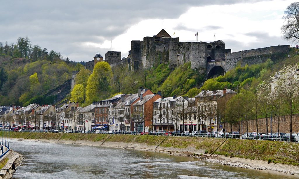
In the Bouillon region
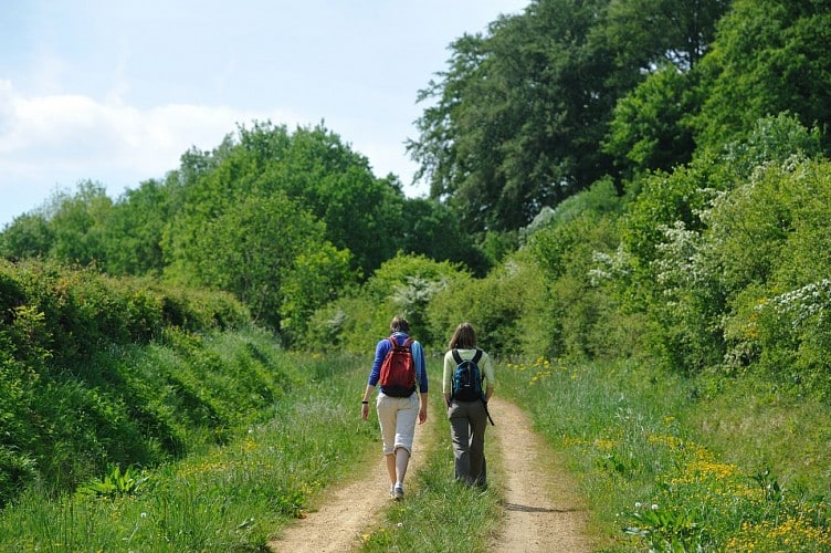
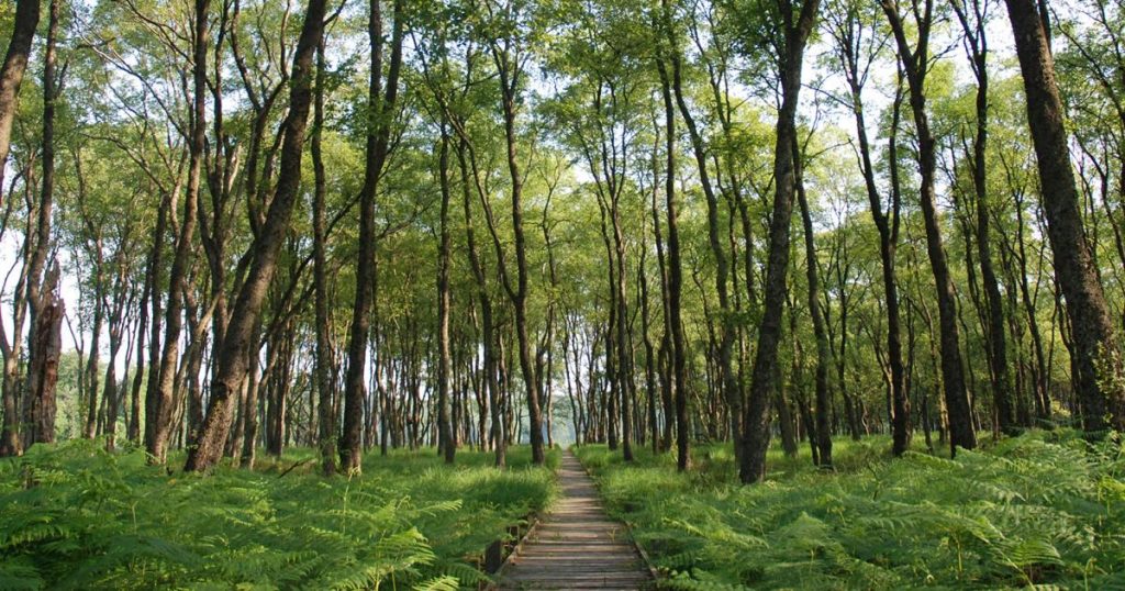
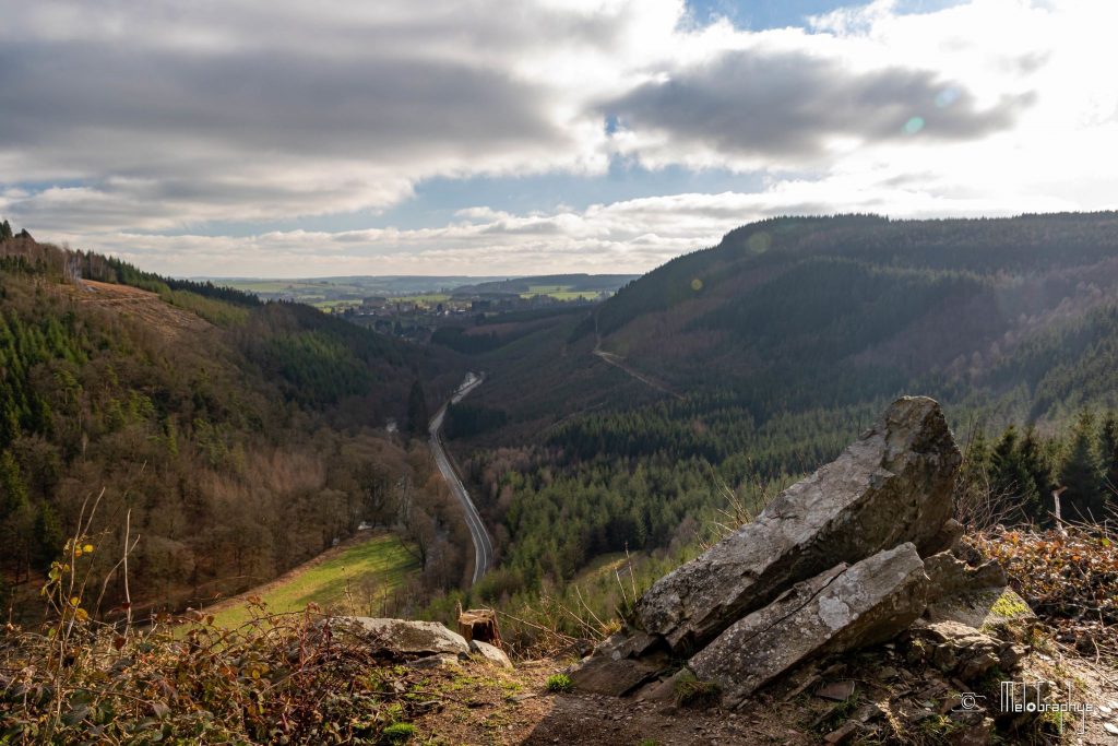
Around the castle of Bouillon – 6.9km
Follow the Semois for almost 7 kilometers from the town of Bouillon, the final stage of the Transardennaise.
Discover its castle and its many secrets from the Pont de la Poulie, which is the starting point. Renovated and developed until the 19th century, Godefroid de Bouillon contributed to the popularity of this formidable fortress.
Admire the town from every angle: Cordemois Abbey, the Moulin de l’Epine and its viewpoint, and the belvedere overlooking Bouillon.
Departure : Poulie bridge (boulevard Vauban, Bouillon)
Distance : 6,9 km – 2h30
Difficulty : medium
Marking : red rectangle
More info and downloadable GPX tracks on the website: https: //walloniebelgiquetourisme.be/fr-be/3/jaime/activites-sportives/randonnees-et-promenades/itineraires-de-randonnees/balade-autour-du-chateau-de-bouillon/39942
©WBT
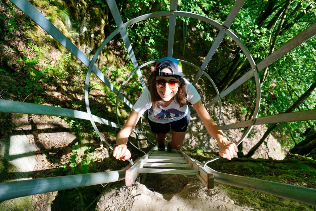
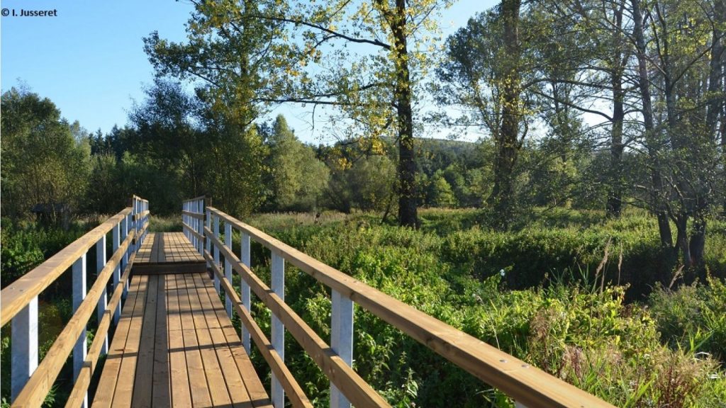
Vertigo walk at Rochehaut – 5km
Watch the Semois from the vertigo walk! You will have to take the steep path and the ladders thrown in the void to go back to Rochehaut. If you like adrenaline and steep hills, this ride is for you!
Departure : Church of Rochehaut
Distance : 5 km
Difficulty : difficult
Marking : red rectangle
More info and downloadable GPX tracks on the website: https: //walloniebelgiquetourisme.be/fr-be/3/jaime/activites-sportives/randonnees-et-promenades/itineraires-de-randonnees/balade-insolite-a-rochehaut-balade-du-vertige/40743
©WBT
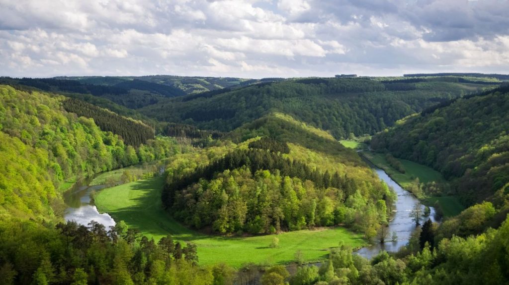
The Botassart panorama – 13km
Discover the Semois around the Giant’s Tomb in Botassart, a breathtaking panorama! A 13 kilometre walk in the forest surrounding the meander of the Semois, a real change of scenery.
Departure : The Giant’s Tomb
Distance : 13 km
Difficulty : Medium
Markings : red rectangle and GR
More info and downloadable GPX tracks on the website: https: //walloniebelgiquetourisme.be/fr-be/content/randonnee-pedestre-incontournable-a-botassart-la-ou-coule-une-riviere
©WBT
Do you want another route? Find more ideas, including 8 walks in the Bouillon region, on the issuu website: https: //issuu.com/optnticbxl/docs/randonn__es_en_wallonie
In the Saint-Hubert area
Paths of solitude – 20 km
A 20 km walk in the heart of the Saint-Hubert forest. Take advantage of your visit to this lush valley to observe the incredible fauna and flora of the Ardennes. But above all enjoy the silence of the surroundings where only the sound of the stream will be perceptible.
Departure : signpost for the start of the walks: “Sapin Fi”.
Distance : 20 km
Difficulty : medium
Marking : blue rectangle
More info and downloadable GPX tracks on the website: https: //walloniebelgiquetourisme.be/fr-be/3/jaime/activites-sportives/randonnees-et-promenades/itineraires-de-randonnees/randonnee-pedestre-incontournable-a-saint-hubert-chemins-de-solitude/40751
©WBT
Bilaude walking tour – 6 km
A natural site in the heart of the Saint-Michel forest, renowned for its game viewing; you may be lucky enough to spot wild boar, deer, roe deer and a few birds. Attention, this circuit is not marked and forms a loop in the forest of Saint-Michel.
Start : Barrière Mathieu – 6970 Tenneville
Distance : 6 km
Difficulty: easy
Marking : no marking
More info and downloadable GPX tracks on the website: luxembourg-belge.be/diffusio/en/voir-faire/balades-randos/a-pied/circuit/balade-pedestre-de-bilaude_TFOCIR19093.php
Find many other ideas for walks and hikes in the Saint-Hubert region on the website of the Saint-Hubert tourist office: https: //www.foretdesainthubert-tourisme.be/se-promener/a-pied/
In the region of Bastogne
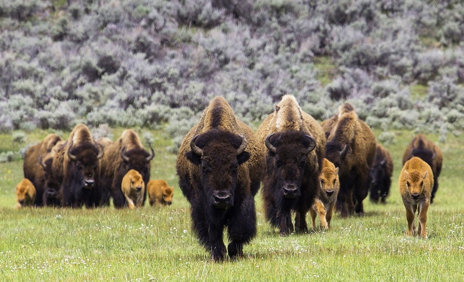
Bison Walk in Recogne – 11.2 km
Discover the herd of 200 bison in a splendid and green setting. This walk, proposed by the Pays de Bastogne tourist office, will also enable you to discover a natural complex of great value, the Fazone pond where various birds and dragonflies can be observed.
Start : Barrière Mathieu – 6970 Tenneville
Distance : 11.2 km
Difficulty: easy
Markings : blue diamond
More info and downloadable GPX tracks on the website: https: //walloniebelgiquetourisme.be/fr-be/content/ferme-des-bisons-a-recogne
©WBT
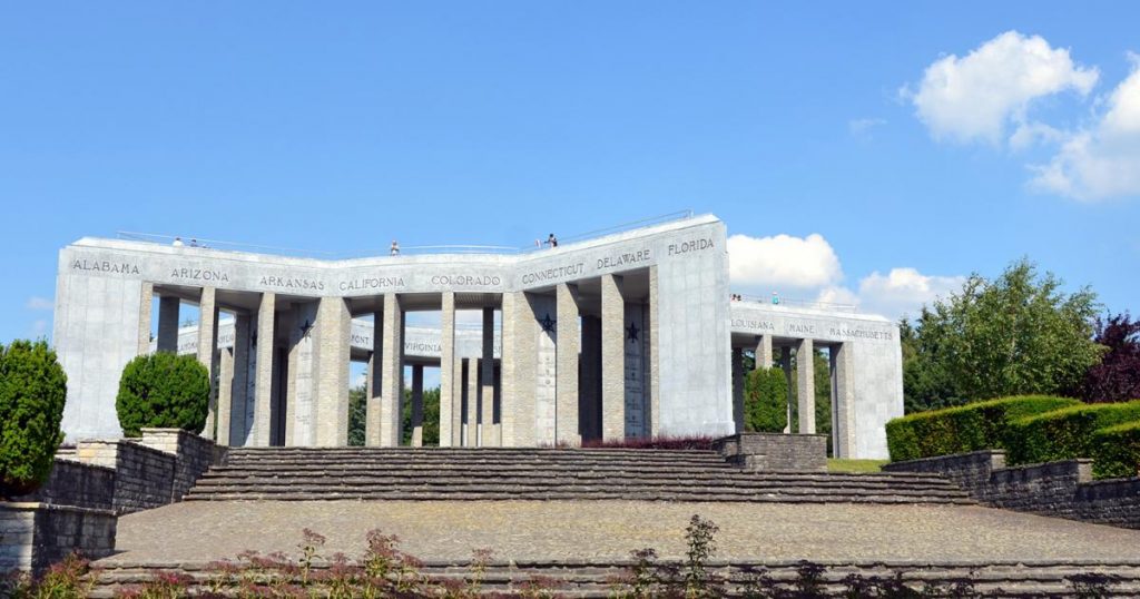
The Remembrance Walk – 17 km
This 17-kilometre walk is a reminder of the Battle of the Bulge in 1944. Enjoy your hike by mixing history, nature and memories.
Departure : Mardasson Memorial – Bastogne
Distance : 17 km
Difficulty: easy
Markings : blue and white rectangle, green diamond
More info and downloadable GPX tracks on the website: https: //walloniebelgiquetourisme.be/fr-be/content/randonnee-pedestre-incontournable-a-bastogne-la-balade-du-souvenir
©WBT
The city of Bastogne offers many other walks and mountain bike tours in its region… Find them on their website: https: //www.bastogne.be/loisirs/sport/balades-pedestres-et-vtt
In the Saint-Ode region
Promenade de la Bonne-Dame – 4.6 km
Admire a breathtaking 180° panorama at the highest point of this walk, the Rocher du Coucou. Discover the spring of the Good Lady, not drinkable, but known for its many miraculous virtues.
Departure : N829, at the exit of the village of Lavacherie
Distance : 4,6 km
Difficulty : medium
Markings : yellow rectangle
In the Gaelic region
On foot, around Montauban – 11 km
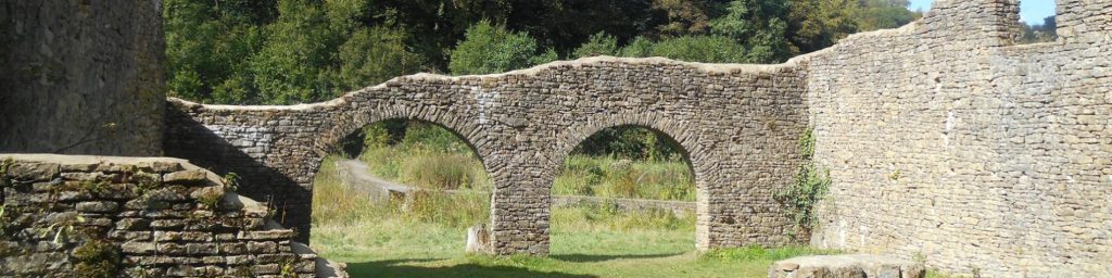
Discover the incredible nature of the Gaume and its special climate during this walk near the Transgaumaise. The ruins of ancient forges from the 15th century, a Celtic refuge and an ancient dungeon form the magnificent site of Montauban. The Gaelic biodiversity has everything to amaze you; flora and fauna with rare and endangered species, small streams forming small waterfalls.
Departure : 6743 Montauban
Distance : 11 km
Difficulty: medium
More info and downloadable GPX tracks on the website: https: //walloniebelgiquetourisme.be/fr-be/content/a-pied-autour-de-montauban-balade-en-gaume
©WBT
Les Hauts de Robelmont – 8.4 km
Discover the heights and undergrowth of Robelmont, near the Transgaumaise route. Nature lovers, you will cross the nature reserve of Meix-devant-Virton and its popular large pines. But don’t miss the ruins of the old farm of Harpigny from the 16th century.
Start : 40 Rue de la Colline – 6769 Meix-devant-Virton
Distance : 8,4 km
Difficulty: easy
More info and downloadable GPX tracks on the website: https: //walloniebelgiquetourisme.be/fr-be/3/jaime/activites-sportives/randonnees-et-promenades/carte-des-balades-pedestres-de-wallonie
©WBT
Discover other walking and cycling routes proposed by the Maison du Tourisme gaumaise: https: //www.visitgaume.be/se-balader-a-pied/


