Hiking Map – Rochefort and its villages
8,00 €IGN hiking map – Rochefort and its villages More than 20 marked routes in the Rochefort region
Showing 13–24 of 30 results
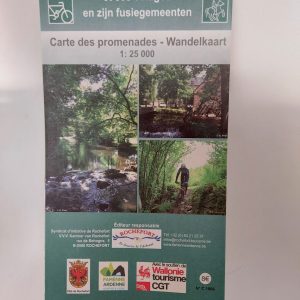
IGN hiking map – Rochefort and its villages More than 20 marked routes in the Rochefort region

This 1:25 000 IGN map was created by the tourist office of Libin. It shows the exact route of the 78 km loop of the “Grand Tour between Lesse and Lomme”. The map also indicates village routes and other day hikes to be done in the area of the Grande Forêt de Saint-Hubert.

Walking map for the commune of Sainte-Ode. This map shows 23 local walks of 2 to 11 km as well as 5 major GTA routes of 16 to 27 km forming the permanent IVV circuit Le Sentier des Vallées de l’Ourthe et du Laval.
Scale: 1/25 000

Lot of hiking maps for the GTA route La Transgaumaise (140 km from Virton). Scale: 1:25,000.

This 1:50,000 scale map shows 480 km of marked ATV trails in the southern part of the Eastern Townships.
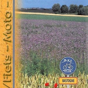
Bike-motorbike-car roadbook for Bastogne. This GTA roadbook includes 3 routes from 9 to 36 km.
var LanguageMenu; var LanguageMenu_keys=["ar","bg","ca","zh-CHS","zh-CHT","cs","da","nl","en","et","fi","fr","de","el","ht","he","hi","mww","hu","id","it","ja","tlh","ko","lv","lt","ms","mt","no","fa","pl","pt","ro","ru","sk","sl","es","sv","th","tr","uk","ur","vi","cy"]; var LanguageMenu_values=["Arabic","Bulgarian","Catalan","Chinese Simplified","Chinese Traditional","Czech","Danish","Dutch","English","Estonian","Finnish","French","German","Greek","Haitian Creole","Hebrew","Hindi","Hmong Daw","Hungarian","Indonesian","Italian","Japanese","Klingon","Korean","Latvian","Lithuanian","Malay","Maltese","Norwegian","Persian","Polish","Portuguese","Romanian","Russian","Slovak","Slovenian","Spanish","Swedish","Thai","Turkish","Ukrainian","Urdu","Vietnamese","Welsh"]; var LanguageMenu_callback=function(){ }; var LanguageMenu_popupid='__LanguageMenu_popup';
var intervalId = setInterval(function () { if (MtPopUpList) { LanguageMenu = new MtPopUpList(); var langMenu = document.getElementById(LanguageMenu_popupid); var origLangDiv = document.createElement("div"); origLangDiv.id = "OriginalLanguageDiv"; origLangDiv.innerHTML = "ORIGINAL: "; langMenu.appendChild(origLangDiv); LanguageMenu.Init('LanguageMenu', LanguageMenu_keys, LanguageMenu_values, LanguageMenu_callback, LanguageMenu_popupid); window["LanguageMenu"] = LanguageMenu; clearInterval(intervalId); } }, 1);
Bike-motorbike-car roadbook for Bastogne. This GTA roadbook includes 3 routes from 9 to 36 km.
GTA bike-car-motorcycle roadbook accompanying the tourist route “La Route de la Sûre”. This roadbook includes a 86 km route in the Sûre region in the province of Luxembourg.
var LanguageMenu; var LanguageMenu_keys=["ar","bg","ca","zh-CHS","zh-CHT","cs","da","nl","en","et","fi","fr","de","el","ht","he","hi","mww","hu","id","it","ja","tlh","ko","lv","lt","ms","mt","no","fa","pl","pt","ro","ru","sk","sl","es","sv","th","tr","uk","ur","vi","cy"]; var LanguageMenu_values=["Arabic","Bulgarian","Catalan","Chinese Simplified","Chinese Traditional","Czech","Danish","Dutch","English","Estonian","Finnish","French","German","Greek","Haitian Creole","Hebrew","Hindi","Hmong Daw","Hungarian","Indonesian","Italian","Japanese","Klingon","Korean","Latvian","Lithuanian","Malay","Maltese","Norwegian","Persian","Polish","Portuguese","Romanian","Russian","Slovak","Slovenian","Spanish","Swedish","Thai","Turkish","Ukrainian","Urdu","Vietnamese","Welsh"]; var LanguageMenu_callback=function(){ }; var LanguageMenu_popupid='__LanguageMenu_popup';
var intervalId = setInterval(function () { if (MtPopUpList) { LanguageMenu = new MtPopUpList(); var langMenu = document.getElementById(LanguageMenu_popupid); var origLangDiv = document.createElement("div"); origLangDiv.id = "OriginalLanguageDiv"; origLangDiv.innerHTML = "ORIGINAL: "; langMenu.appendChild(origLangDiv); LanguageMenu.Init('LanguageMenu', LanguageMenu_keys, LanguageMenu_values, LanguageMenu_callback, LanguageMenu_popupid); window["LanguageMenu"] = LanguageMenu; clearInterval(intervalId); } }, 1);
GTA bike-car-motorcycle roadbook accompanying the tourist route “La Route de la Sûre”. This roadbook includes a 86 km route in the Sûre region in the province of Luxembourg.
GTA bike-car-motorcycle roadbook for the route La Transardennaise. This roadbook includes the 164 km route from La Roche-en-Ardenne to Bouillon.
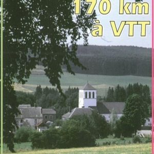
GTA roadbook for the La Transardennaise mountain bike route. This roadbook includes the 170 km route of La Transardennaise Sud from La Roche-en-Ardenne to Bouillon.
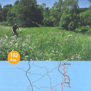
GTA Roadbook for the MTB route La Transardennaise Nord. This roadbook includes the 102 km route of La Transardennaise Nord from Malmedy to La Roche-en-Ardenne.

Marked trails

Freedom Travels

The Ardennes specialist

Quality accommodation

Cycling & mountain biking holidays

Luggage transport
No products in the cart.