
Roadbook for Discovery – Guidance application
Follow your route in real time on your phone with a guidance application!
Europ’Aventure offers you the opportunity to follow the different stages of your hike accompanied by a guidance application available on your smartphone. This wizard will give you access to the following features:
- For each stage, a GPS guidance (no need for 4G access!!!) from the departure to the arrival accommodation;
- Information about the villages you pass through, their culture, fauna, flora, heritage, etc. ;
- Practical information (address, telephone number, etc.) on accommodation, rest areas, viewpoints and shops in the immediate vicinity of your route.
For your information, it is not necessary to have the app to follow our hiking trails or enjoy your stay. The application simply enhances your experience.
The use of “Roadbook for Discovery
You’re about to set off on your first hike with this Roadbook for Discovery guidance application.
How to download the application on your phone? How do I log in and download my trip?
How to start guiding on the first day of the trip? Here are a few explanations to help you understand this new travel journal.
Before you leave
- Download the “Roadbook for Discovery” application on Google Play (Android) or Apple Store (Iphone). This application is represented by a light blue icon and a winding path.
- When the application has been fully downloaded, open it. Enter your e-mail address and the password you received by e-mail.
- Select and validate your trip. The application will download the entire content of your trip to your smartphone. Depending on the quality of the network, this can take several minutes. We advise you to be connected to Wifi for downloading.
- Once you have downloaded your trip, you will find all the information related to it in the main menu. You can connect in off-line mode or in airplane mode.
Navigate the different menus
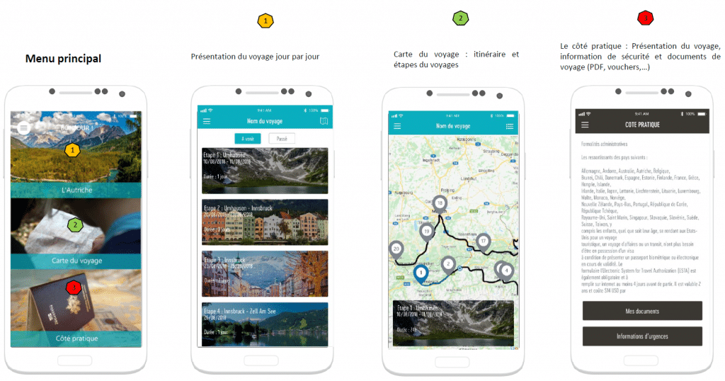
The application offers a main menu with three main sections:
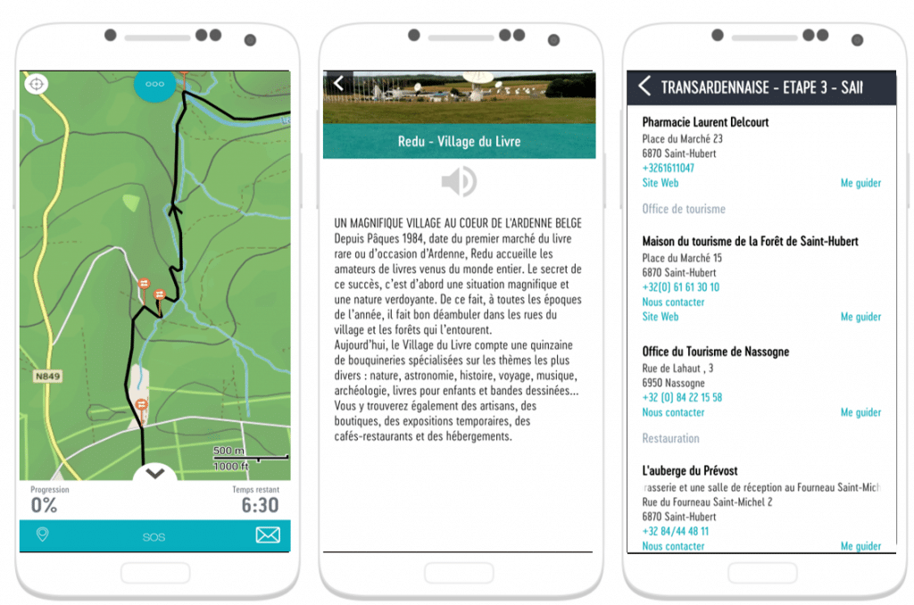
- You will find the complete details of each stage (hotels and itinerary of the day) in“Your trip”.
- “You will find themap of the trip where you will find the plan of the global itinerary including all the stages of your stay.
- “You will find all the documents you need for your reservation (road book, vouchers, …)as well as security information.
The first tab “Your trip” is presented day by day. In each stage, you will find a general presentation of the day, the walking stage and the accommodation of the day.
By clicking on a stage, you will find a short description of the hike with the estimated duration, the positive and negative altitude difference as well as the level of difficulty. In this tab, you will also find two icons:
- “A car”: guides you to the starting point of the stage
- “A triangle”: allows you to start guiding in real time.
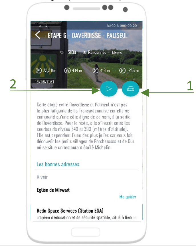
The itinerary is composed of the GPX track, directions and explanations on the points of interest (nature, heritage, viewpoints, food shops, …). The application will orally give you directions and explain points of interest along the way.
During the year 2021, the application is available for the 4 main routes, namely the Transardennaise, the Transgaumaise, theEscapArdenne – Eisleck Trail and the Grand Tour between Lesse and Lomme. From 2022, the application will be available on all our stays.
Do not hesitate to come back to us if you have any comments or questions regarding the installation or use of the Roadbook for Discovery application.
Dictionary of Adventure
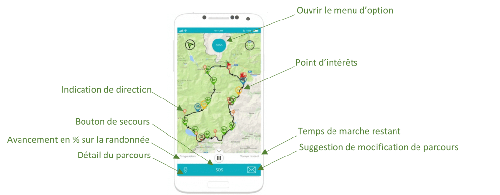
Being magnetized on the track: Once on the track, the voice guidance tells you the directions to take: you are magnetized on the track. If you leave the track, an audible and visual alert indicates that you have left the track, and brings you back to it.
POI’s: On your way you will meet two types of POI’s.
– Directional POIs to guide you by voice on the trail, e.g. “turn right
– Points of interest to discover the destination.
They are triggered when you pass near them.

Partners: The courses may include partners. By clicking on them, you can consult their description (address, phone number…). A feature allows you to be guided there.

A few tips
- Don’t hesitate to use an external portable battery as the GPS usually uses a large amount of your smartphone’s battery.
- Downloading before your trip allows you to access it without a connection. So you can turn off your 4G data and put your phone in airplane mode if you want to save battery.
- The application gives directions as well as explanations of points of interest verbally. You will also be given a verbal warning if you leave the path of the route. Your phone can therefore be stored in your pocket or backpack.
- An “SOS” button, displayed at the bottom of the screen throughout your ride, allows you to call an emergency number or send them your GPS coordinates in case of an accident.


